Precise Location of Japanese Islands
Hydrographic and Oceanographic Department(HOD)is making precise positioning of the four Japanese main islands and other small islands in the World Geodeic System with satellite laser ranging techniqes. The primary purpose is to determine the limits of the Japanese territorial waters and EEZ.
Laser Ranging Observation
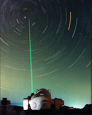
HOD has a positioning reference point for Japanese main islands at Shimosato Hydrographic Observatory, which the satellite laser ranging observations have been performed since April,1982.
Through these observations with measuring the round traval time of the laser light up to the geodetic satellites, such as LAGEOS and AJISAI(see below),the precise location of the reference point in the World Geodetic System is monitored.
 |
 |
Satellite Laser Ranging Staion
(Shimosato Hydrographic Observatory) |
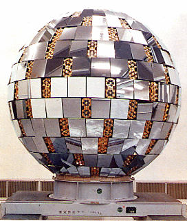
Japanese Geodetic Satellite "AJISAI"
The Satellite is 215cm in diameter and weighs of 585kg.
At altitude of 1500km,it circles around the Earth in about 2hours.
The National Space Development Agency of Japan launched it in 1986. |
[ top page ]