This is a report of aeromagnetic survey by the Hydrographic Department in 1997. This report gives the compiled results of Kuti-no-Erabu Sima and Suwanose Sima.
Key word : aeromagnetic survey.
1. Survey
The aircraft used for the survey was YS-11 which had been remodeled so that its flying range be extended and that magnetic survey be carried out on board. The aircraft was equipped with a tail-stinger of non-magnetic plastics of 1.5 meters long at the rear of the fuselage. The instruments used for the survey were a proton magnetometer and GPS/OMEGA receivers.
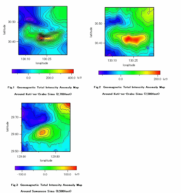
The proton magnetometer measured geomagnetic total intensity once per two seconds with an accuracy of +/-1 nano-tesla. The flight altitudes were 2,700 feet and 7,500 feet(Kuti-no-Erabu), and 9,500 feet(Suwanose), respectively.
2. Data processing and results
The measured total intensity include components of external field variation. The correction of the external field variation was carried out based on the continuous magnetic observations at a reference magnetic observatory close to the survey area.
For calculations of magnetic anomaly, the IGRF1995 was used as the core field model in accordance with the recommendation of the IAGA.
The details on the compiled aeromagnetic surveys are listed in Table 1.
Fig.1-3 shows the magnetic anomaly of the total intensity around of the Kuti-no-Erabu Sima and Suwanose Sima.
Reduction and compilation of this report have been made by K. Kumakawa, N. Sasahara and K. Kawamura of Geodesy and Geophysics Division.