Shimosato Hydrographic Observatory
About SHO
- Overview
- Shimosato Hydrographic Observatory (SHO) is an observatory of Japan Coast Guard. SHO is the primary reference point for the marine geodetic network around Japan. Satellite Laser Ranging (SLR) observation and GNSS observation have been carried out at SHO.
Besides, SHO's SLR and GNSS obervation detect the crustal deformation caused by the subduction of the oceanic plates. SHO also contributes to detect seafloor crustal deformation as the reference point of the seafloor geodetic observation.
- Satellite Laser Ranging
- SHO's SLR observation has been carried out since 1982, in order to maintain and improve the accuracy of the nautical charts. SLR observation is one of the techniques to determine the range from SLR station to satellites. SLR system measures the round-trip time of laser pulses reflected at the satellites, and hence distance.
There are 30-40 laser ranging observatories all over the world. Observed data are collected and shared at the data center. Using these global data, we determine the precise position of Shimosato station. For the geodetic and geophysical purpose, our SLR data contributes to determine the precise orbit of satellites.
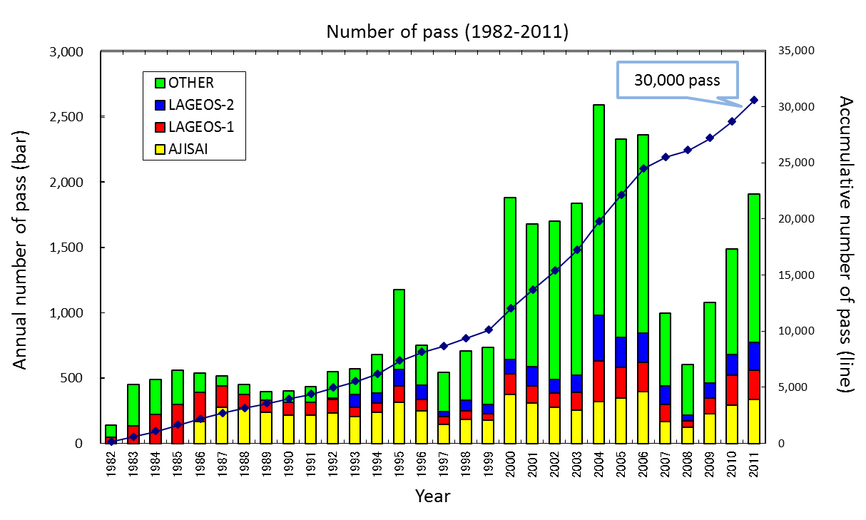
Past Results (Number of pass)

Last-Modified: Nov 12, 2012
