
Hydrographic and Oceanographic Department
| About us | Notices to Mariners | Navigational Warnings | Realtime Tidal Data | Oceanographic Data: JODC | EAHC | International Activities |
International Activities - for Hydrography and Oceanography in the World
JHOD, as a responsible organization of Japan for the International Hydrographic Organization (IHO), has actively participated in international meetings to contribute to establishing international standards in hydrographic field and has developed global partnership through exchanging hydrographic data and information with many countries.
JHOD has also participated in various oceanographic research projects promoted by international organizations such as UNESCO/Intergovernmental Oceanographic Commission (IOC) and International Science Council (ISC) to contribute international research and activities on climate change and marine environmental protection.
JHOD has furthermore contributed to improving hydrographic services in other countries by transferring hydrographic knowledge and skills through providing a training course for or dispatching experts of JHOD to other counties following the request by those counties using international assistance programs.
International Collaboration on Hydrographic Services
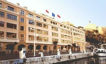 IHO Secretariat in Monaco
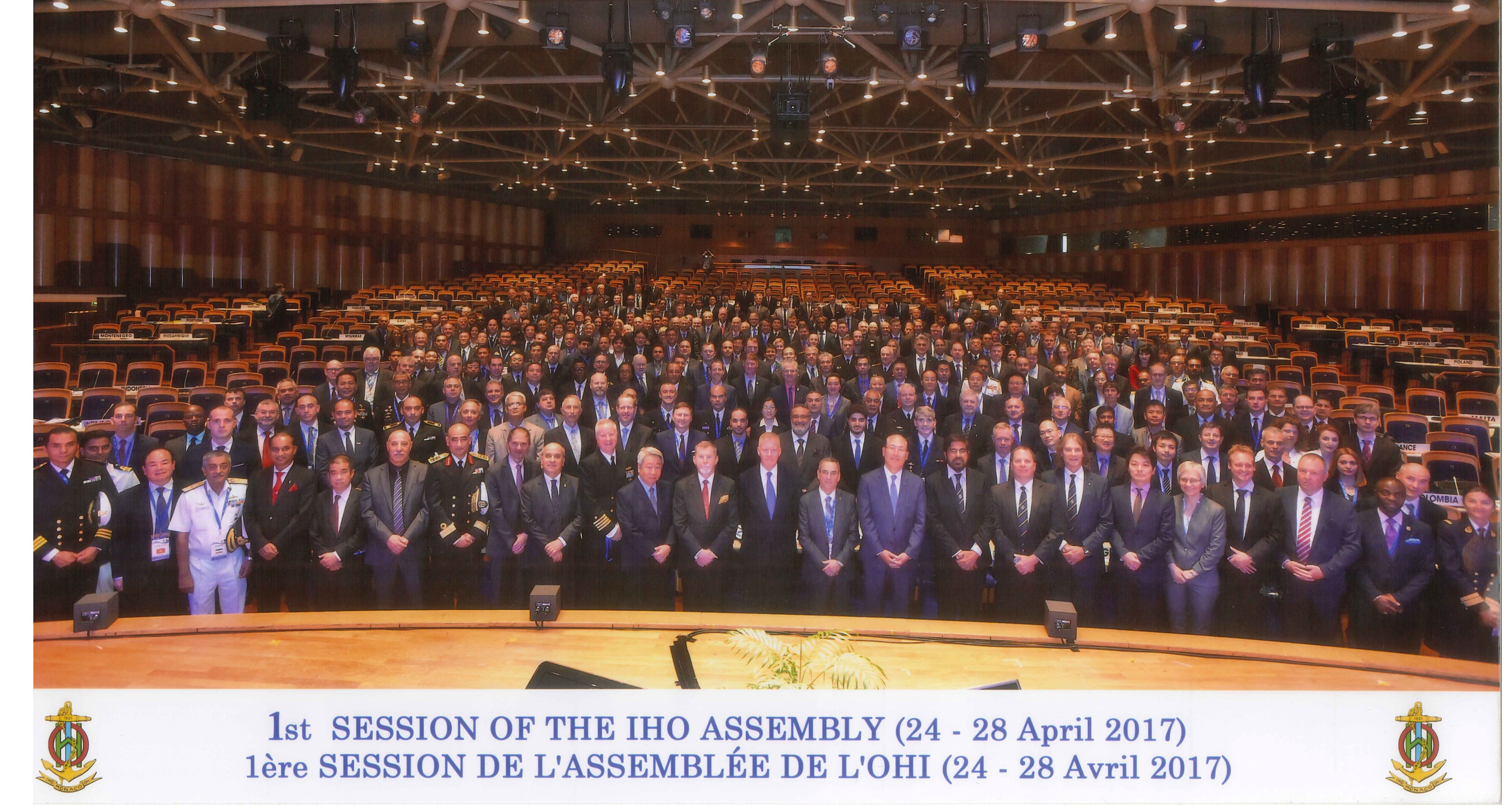 IHO Assembly in 2017
International Hydrographic Organization (IHO)
International Hydrographic Organization (IHO) was established in 1970 under the "Convention on the International Hydrographic Organization", as an international organization which has a consultative and purely technical nature (103 member states as of July 2025). The goal of the IHO is to contribute to making navigation easier and safer throughout the world by improving nautical charts and documents. The IHO Secretariat is placed in the Principality of Monaco.
JHOD has contributed in IHO to establish international standards on hydrography and cartography as well as to improve capacity by positively participating in the activities of the IHO as a member of the IHO committee and working groups.
JHOD has also been sending a staff member to the IHO Secretariat since 2008 to support its activities.
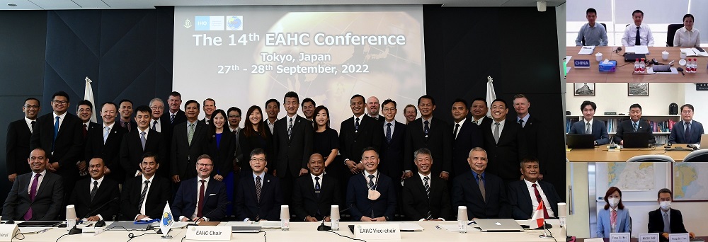 EAHC Conference in 2022
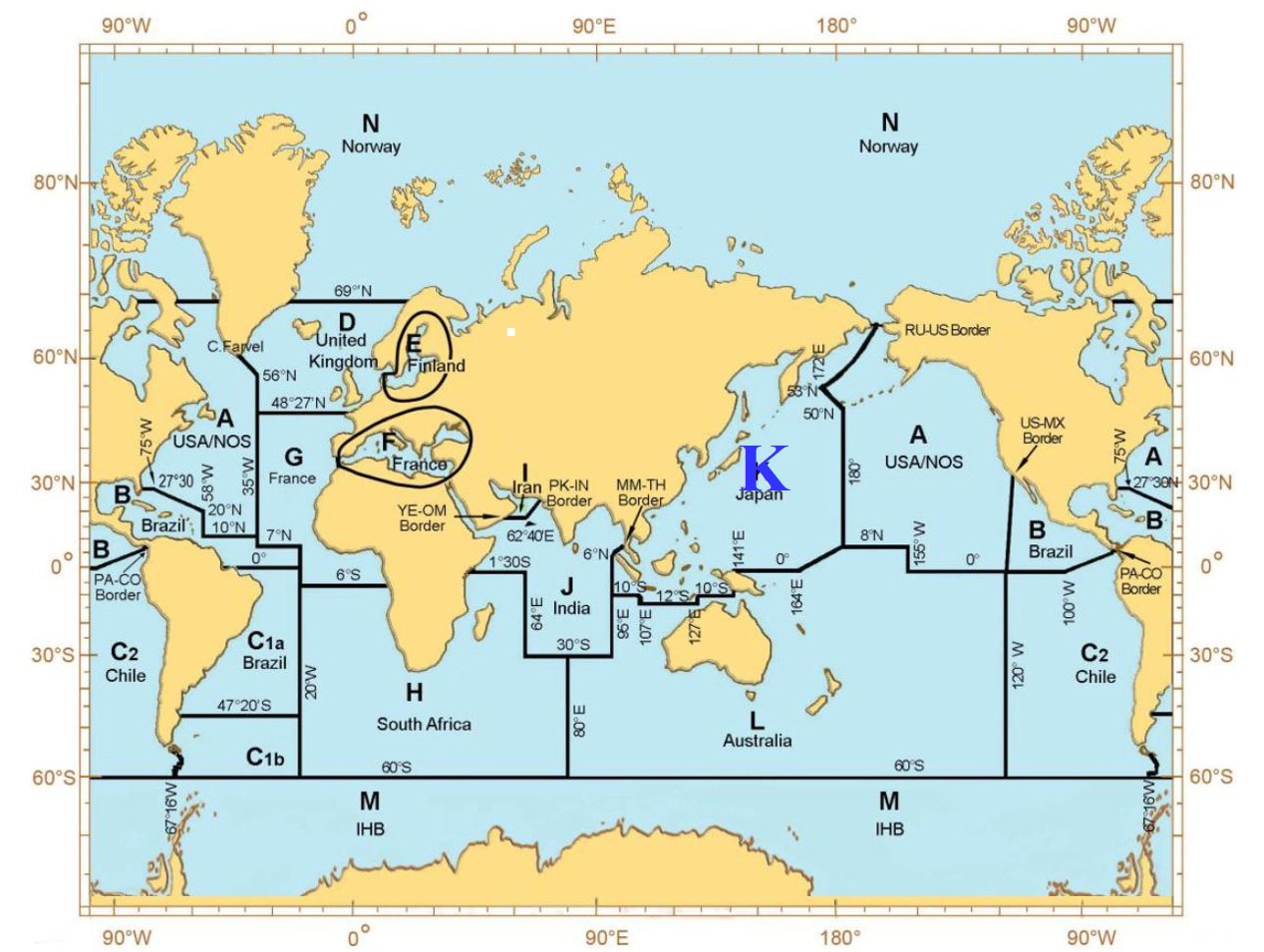 INT Chart K region
East Asia Hydrographic Commission (EAHC)
IHO has encouraged to establish a regional hydrographic commission (RHC) in each region in the world to facilitate regional hydrographic activities and cooperation.
East Asia Hydrographic Commission (EAHC) is one of the RHCs and consists of 10 countries, China, DPR of Korea, Indonesia, Japan, Malaysia, Philippines, Rep. of Korea, Singapore, Thailand and Brunei.
Japan has served as the permanent secretariat for EAHC since its establishment to make efforts on the development of hydrographic activities in the region. Japan also has taken on a role of the coordinator for the region K that coordinates publishing of the INT Charts in Northwestern Pacific Ocean to effectively cover the world ocean by a single set of the paper charts at medium and large scale.
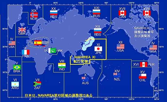 Cover Area of NAVAREA XI (yellow)
NAVAREA XI Navigational Warnings
Emergency information against safety of navigation such as a firing exercise at sea has been promulgated mainly on radio by the coastal states as Navigational Warnings.
The World-Wide Navigational Warning Service that has been established through the joint efforts of the IHO and International Maritime Organization (IMO), is a coordinated global service for promulgation of navigational warnings and, consists of 21 Navigational Warning Areas (NAVAREAs).
Japan has been appointed as a coordinator for NAVAREA XI to grasp navigational warnings and provide advice to the coastal states in the region when necessary.
International Collaboration on Oceanographic Research
 IODE meeting in 2011
Contribution to Research on Climate Change and Protection of Marine Environment
JHOD has participated in ocean research projects promoted by international organizations such as UNESCO/International Oceanographic Commission (IOC) and International Science Council (ISC) and has contributed to clarification of mechanism on climate change and marine environment fluctuation.
A tide station at the Showa station in the Antarctica maintained by JHOD consists part of the network of the Global Sea Level Observing System (GLOSS). It has been utilized for sea level research as well as for monitoring of marine disaster like tsunamis.
Japan Oceanographic Data Center (JODC) of JHOD is a representative institute of Japan as the National Oceanographic Data Center in the International Data and Information Exchange (IODE) system promoted by UNESCO/IOC. JODC has assisted marine research and development activities through comprehensively collecting and managing oceanographic data obtained by institutes in Japan and providing the data to various users and also exchanging the data with the data centers in the world.
International Assistances
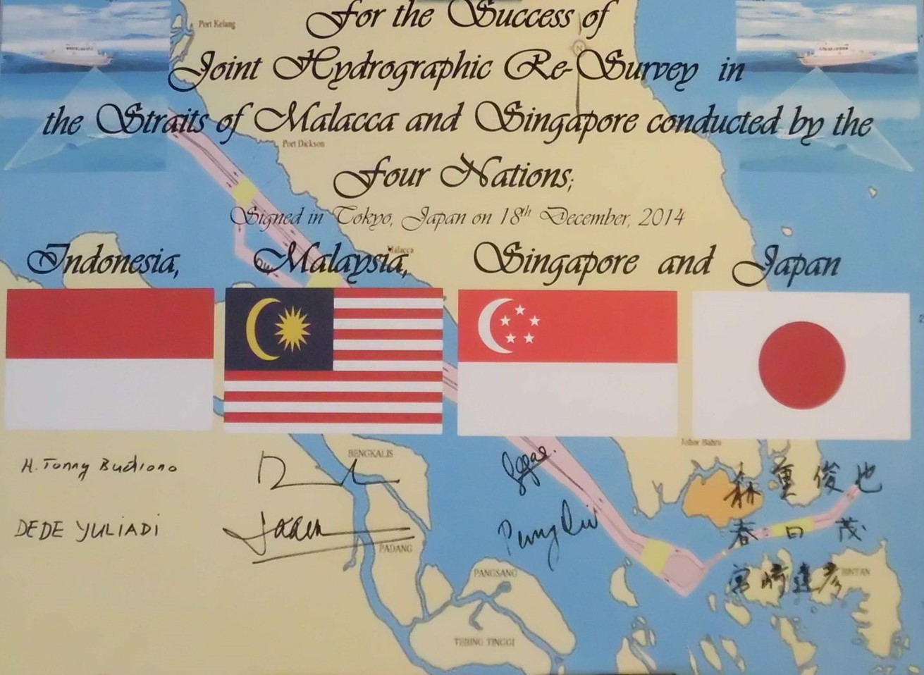 Signature of Malacca-Singapore Strait Technical Cooperation in December 2014
International Assistances
JHOD has assisted improvement of hydrographic services in other countries through dispatching experts in cooperation with Japan International Cooperation Agency (JICA) etc. following the requests by those counties.
The Strait of Malacca-Singapore (SoMS) is one of important sea lanes for the world and also for Japan to support the economic activities. Following the request by the coastal states of SoMS, JHOD as the competent agency in Japan on hydrography, has repeatedly provided technical assistance by dispatching experts to the joint hydrographic survey project of SoMS promoted by JICA etc. since 1969, and then as the results, the paper charts of SoMS were published in 1982 and ENCs in 2005.
In 2014, the joint re-survey project of the strait was started by the three coastal states on the support of Japan. JHOD has supported the project from technical perspectives.
The following projects are also some of the international assistance projects which JHOD was involved.
- 2022-: Solomon Islands: Project for Development Support of Electronic Navigational Charts in Solomon Islands (JICA)
- 2013-2016: Cambodia: Project for Productions of Integrated Digital Terrain Model and Electronic Navigational Chart in the Kingdom of Cambodia (JICA)
- 2011-2012: Vietnam: Support Program for Anti-piracy and Maritime Safety (Ministry of Land, Infrastructure, Transport and Tourism)
- 2010: Papua New Guinea: Project on Promotion of Development of Electronic Navigational Chart in neighboring countries in Asia (Ministry of Land, Infrastructure, Transport and Tourism)
- 2008-2009: Sri Lanka: Project on Promotion of Development of Electronic Navigational Chart in neighboring countries in Asia (Ministry of Land, Infrastructure, Transport and Tourism)
- 2006-2007: Sri Lanka: Support Program for Tsunami Disaster Prevention (Ministry of Land, Infrastructure, Transport and Tourism)
- 2000-2005: Philippines: Technology Development for Electronic Navigational Charts (ENC) (JICA)
- 1999-2003: Mauritius: Establishment of Hydrographic Unit (JICA)
- 1995-1999: Fiji: Preparation of Nautical Charts in the Northern Lau Islands Region in the Republic of Fiji (JICA)
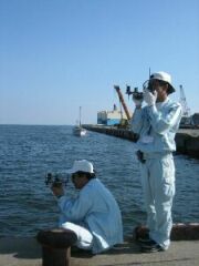
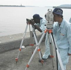 Field Practice of Hydrographic Survey
JICA Group Training Course on Hydrographic Survey
JHOD has been conducting 6-month group training course for hydrographic surveyors in developing countries every year since 1971 in cooperation with JICA. This training course titled "JICA Knowledge Co-Creation Program (Group and Region Focus) on "Hydrography for Charting and Disaster Management (Internationally Accredited Category B) " has maintained an internationally recognized certificate for hydrographic surveyor since 1988.
442 trainees from 44 counties completed the training course as of June 2021 and they have been involved in the hydrographic activities in their countries.
* This training course was suspended in 2020 and 2021 due to the COVID-19.
- Record of Training Participants (as of June 2021)
- Outline of the training course
- Contents of the JICA Group Training Course -training in 2014-
- [Introduction Video] Hydrography for Charting and Disaster Management
How to apply to the JICA group training course
- 1. Course formulation
- Around March through July every year, the training course scheduled in the following year is reviewed and the contents of ongoing course is planned out, while the training course is implemented for three years plan and carried out in Japan once a year.
- 2. Needs survey
- Early summer, the Japanese embassies and JICA overseas offices conduct a needs survey with developing counties to confirm the desire to participate in the training course in the following year and screen the participating counties.
- 3. Selection of participants
- Earlier in the year the training course is conducted, JICA sends general information of the training course to the selected countries requesting a list of recommended organizations and nominees, and then Japan makes a final selection of the training participants from the nominees considering his/her capacity, suitability and so on for the training course.
- [ Inquiry on the training course ]
- Contents of the training course: please contact to JHOD
- Application procedure for the training course: please contact to JICA overseas offices
Other International Collaboration
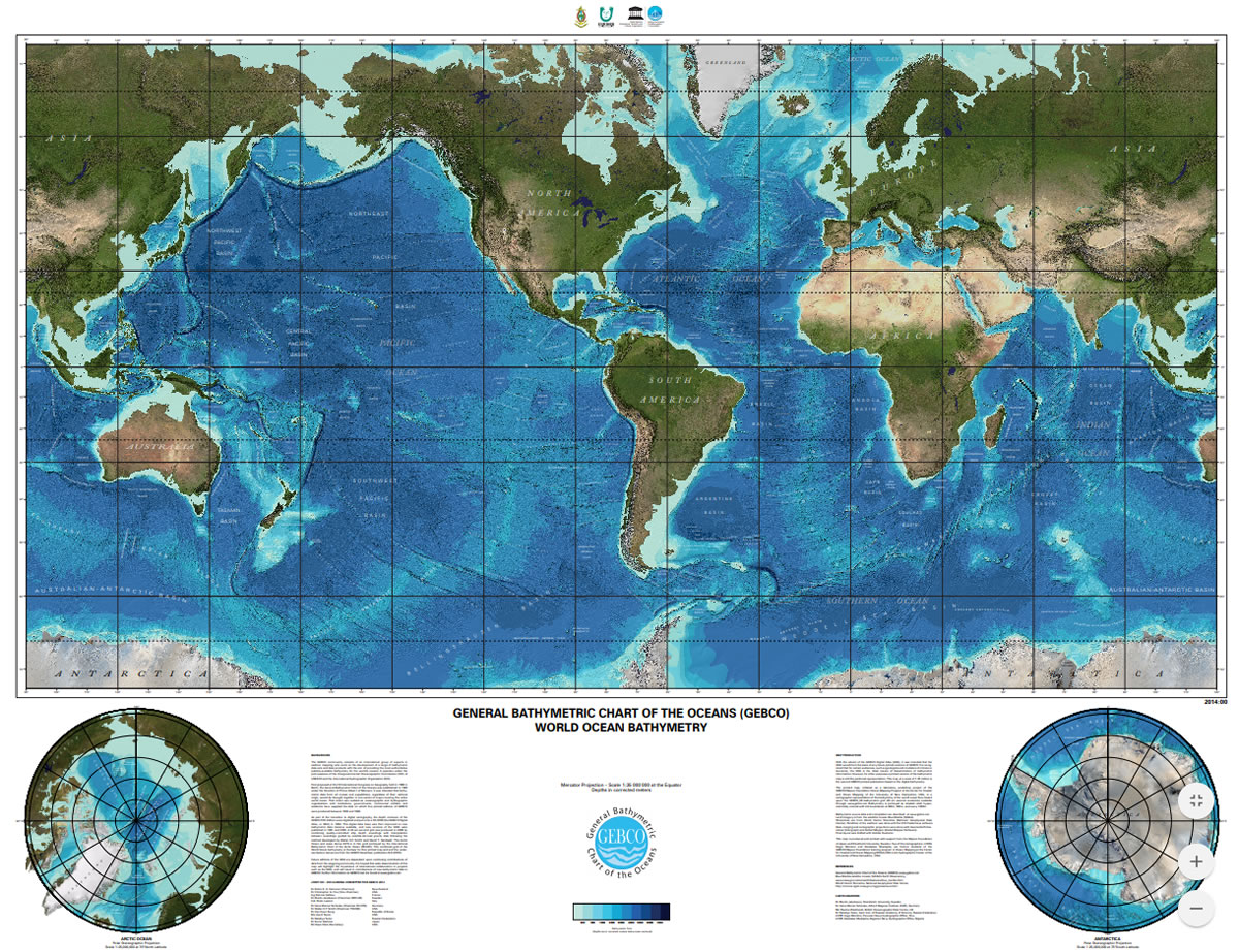 Bathymetric Chart of GEBCO
International Collaboration on Producing Nautical and Bathymetric Chart
IHO has been organizing a 15 week training course titled "Japan Capacity Building Project (Internationally Accredited Category B)" to train cartographers of the member states at United Kingdom Hydrographic Office (UKHO) every year since 2009, financially supported by the Nippon Foundation.
In 2014, it had a change of the project operation and the project title to "IHO-NF GEOMAC Project". JHOD has participated in management of the project since its establishment, and 72 cartographers from 41 countries have completed the training as of June 2021.
IHO and UNESCO/IOC has jointly worked to provide the most authoritative publicly-available bathymetry of the world’s oceans, General Bathymetric Chart of Oceans (GEBCO). Since the first edition of GEBCO was published in 1903, it has been improved and revised by the cooperation of experts from the world including the JHOD experts.
Since 2004, GEBCO project has conducted a 1-year training course (Internationally Accredited Category A) at the University of New Hampshire in USA every year with support by Nippon Foundation for capacity building to enhance GEBCO project. 107 trainees from 44 countries finished the training program as of October 2022.
The GEBCO Sub-Committee on Undersea Feature Names has maintained undersea feature names and makes available them in the world through the IHO-IOC GEBCO Gazetteer of Undersea Feature Names. JHOD staff has participated in the Sub-Committee as the committee member and many undersea feature names connected to Japan have been adopted.