GARPOS format GNSS-A observation dataset
Japanese page is here
The GNSS-A observation dataset obtained by the observation methodology described in this page (in Japanese) converted to the GARPOS format are available on this page.
For details, please see Watanabe et al. (2020, Front. Earth Sci.).
The data released in this page is for researchers.
GNSS-A observation dataset used in our research paper
When using the observation datasets
The observation datasets are licensed under Creative Commons Attribution Non Commercial 4.0 International license.
Please cite the reference when using the datasets.
Note that different DOIs are registered to the datasets listed above.
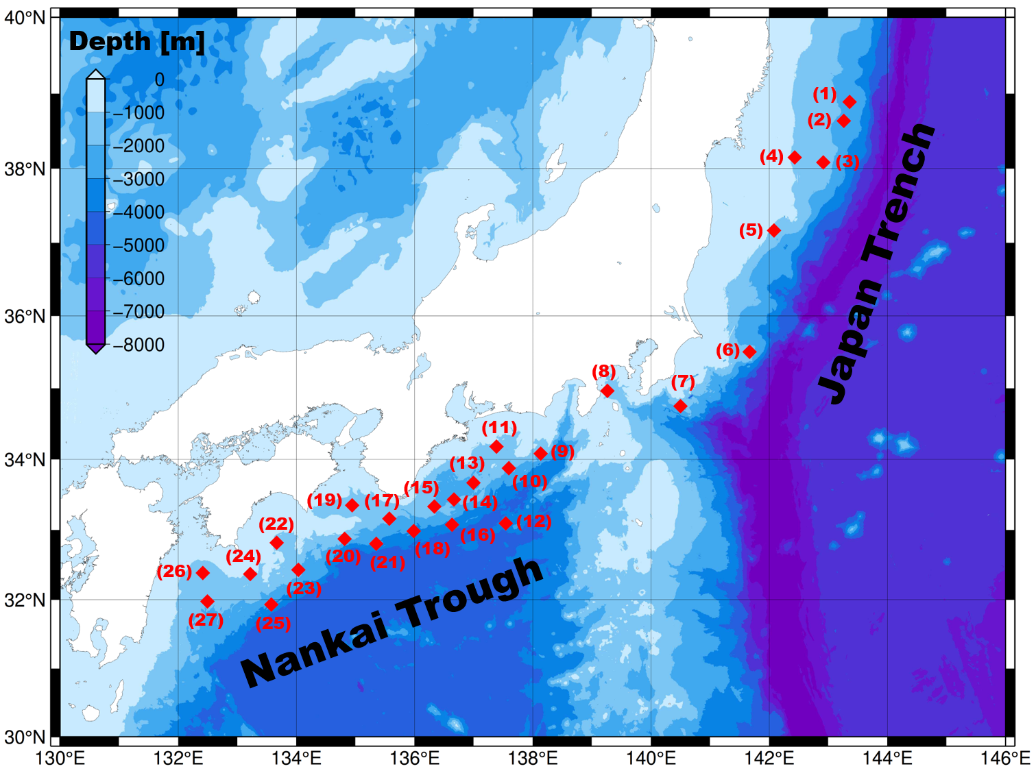
All observation datasets
The observation datasets of all sites are available here.
The datasets may change due to updates in the data processing method.
|
Site name |
|
Site name |
|
Site name |
| (1) |
KAMN |
(10) |
TOK2 |
(19) |
MRT1 |
| (2) |
KAMS |
(11) |
TOK3 |
(20) |
MRT2 |
| (3) |
MYGI |
(12) |
ZENW |
(21) |
MRT3 |
| (4) |
MYGW |
(13) |
KUM1 |
(22) |
TOS1 |
| (5) |
FUKU |
(14) |
KUM2 |
(23) |
TOS2 |
| (6) |
CHOS |
(15) |
KUM3 |
(24) |
ASZ1 |
| (7) |
BOSN |
(16) |
KUM4 |
(25) |
ASZ2 |
| (8) |
SAGA |
(17) |
SIOW |
(26) |
HYG1 |
| (9) |
TOK1 |
(18) |
SIO2 |
(27) |
HYG2 |
